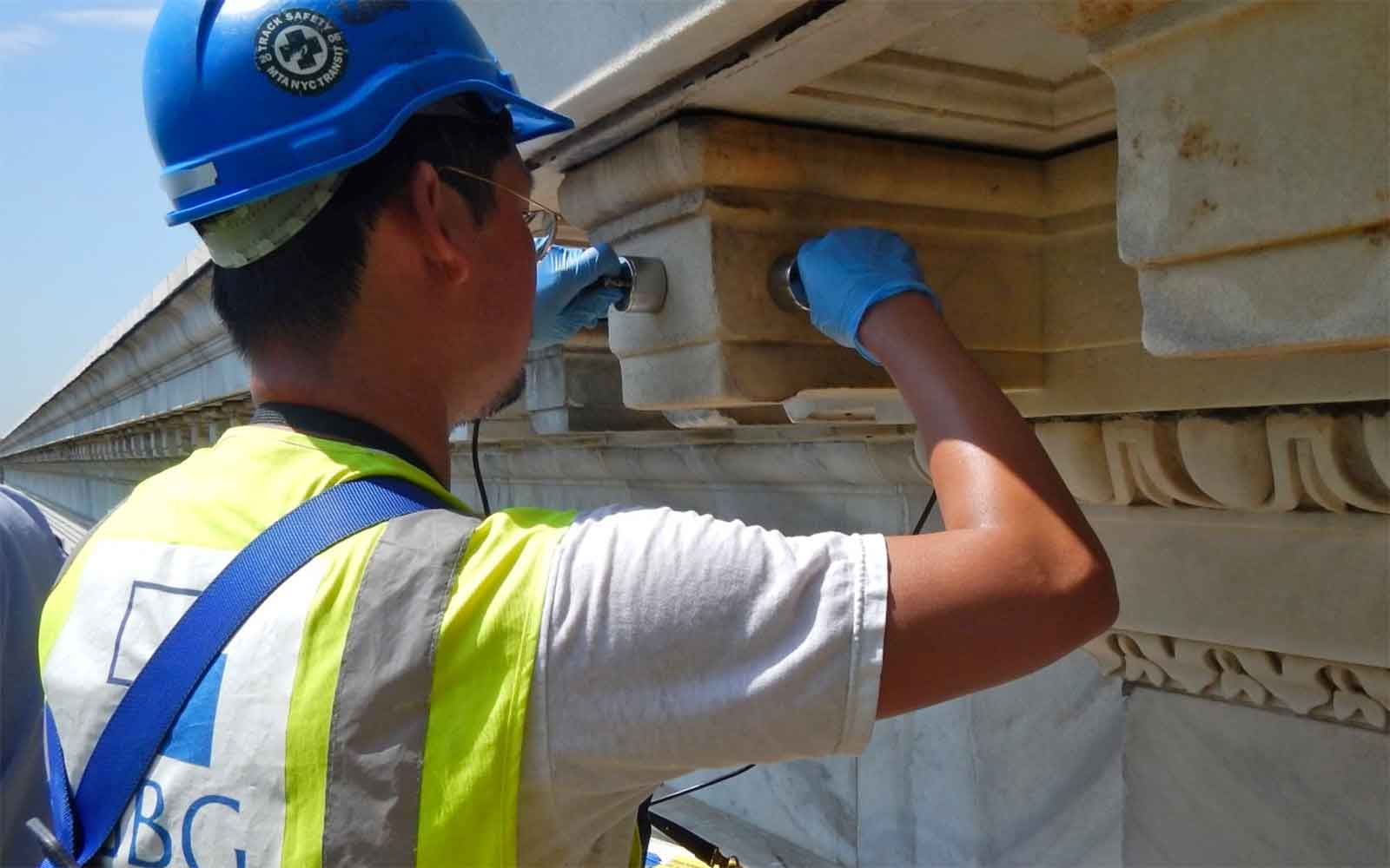
Documentation and Measured Building Survey (MBS) Services
GBG provides Measured Building Survey (MBS) services to generate BIM models and baseline documentation databases for buildings, which can then be used for detailed conditions surveys and more.
Documentation
GBG provides Measured Building Survey (MBS) services using Laser Scanning and Photogrammetry techniques to generate BIM models and baseline documentation databases for buildings, which can then be used for detailed conditions surveys, forensic evaluation and design/repair designation.
Methods include:
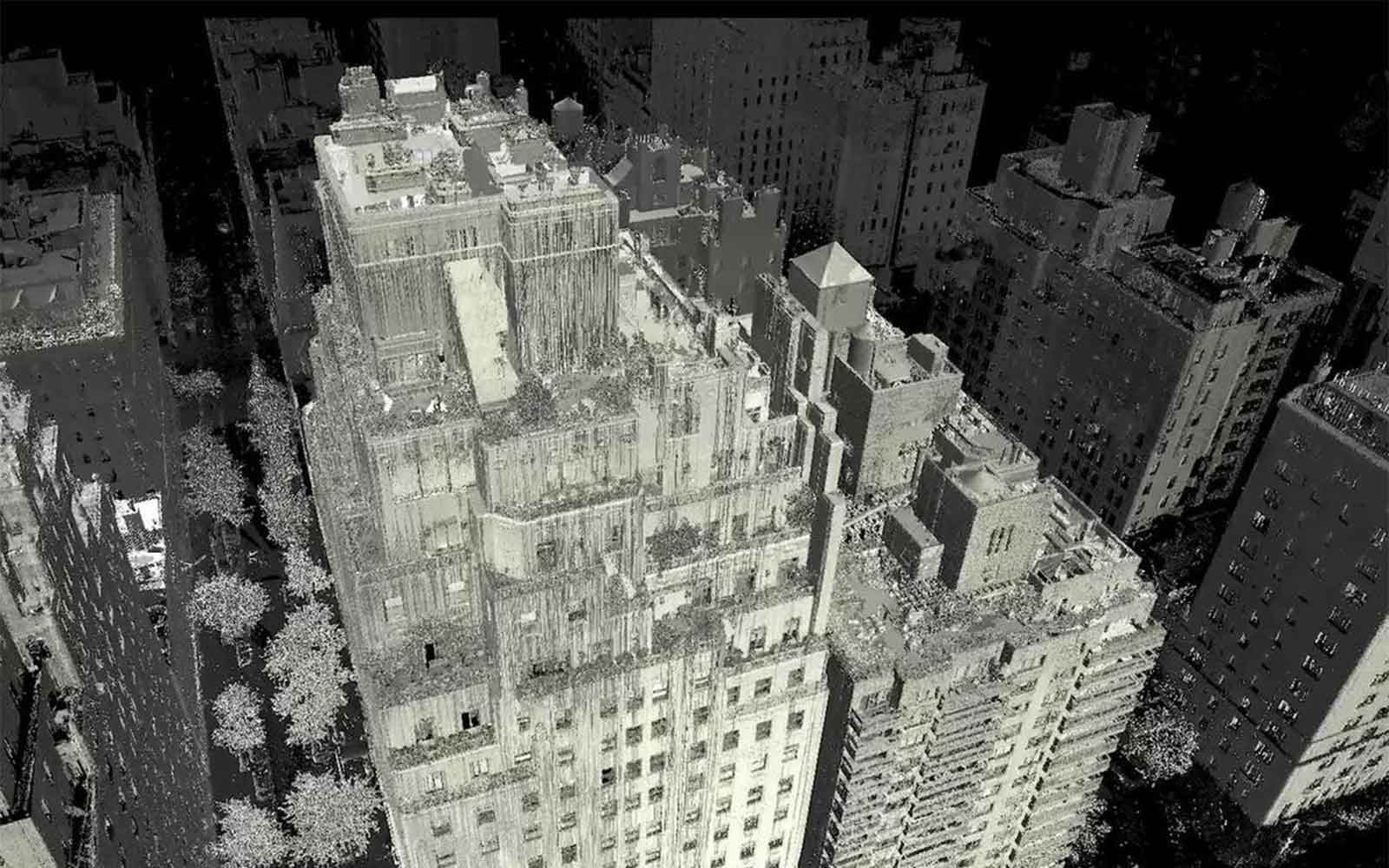
Laser Scan Survey
Large volumes of data collected in a short period of time. Data can be used for as-built drawings, orthophotography and 3D modeling.
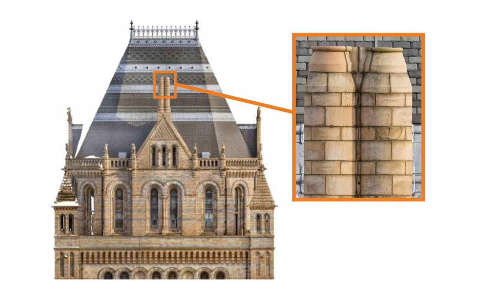
Orthophotography
Orthophotographs are working photorealistic elevations that are zoomable, measurable and can be used for conditions assessments. The full-scale historic façade (left) and magnified view (right) of cracked terra cotta. Crack widths can be measured from these images. The orthophotographs are collected facing the object dead-on (in this case using an aerial boom).
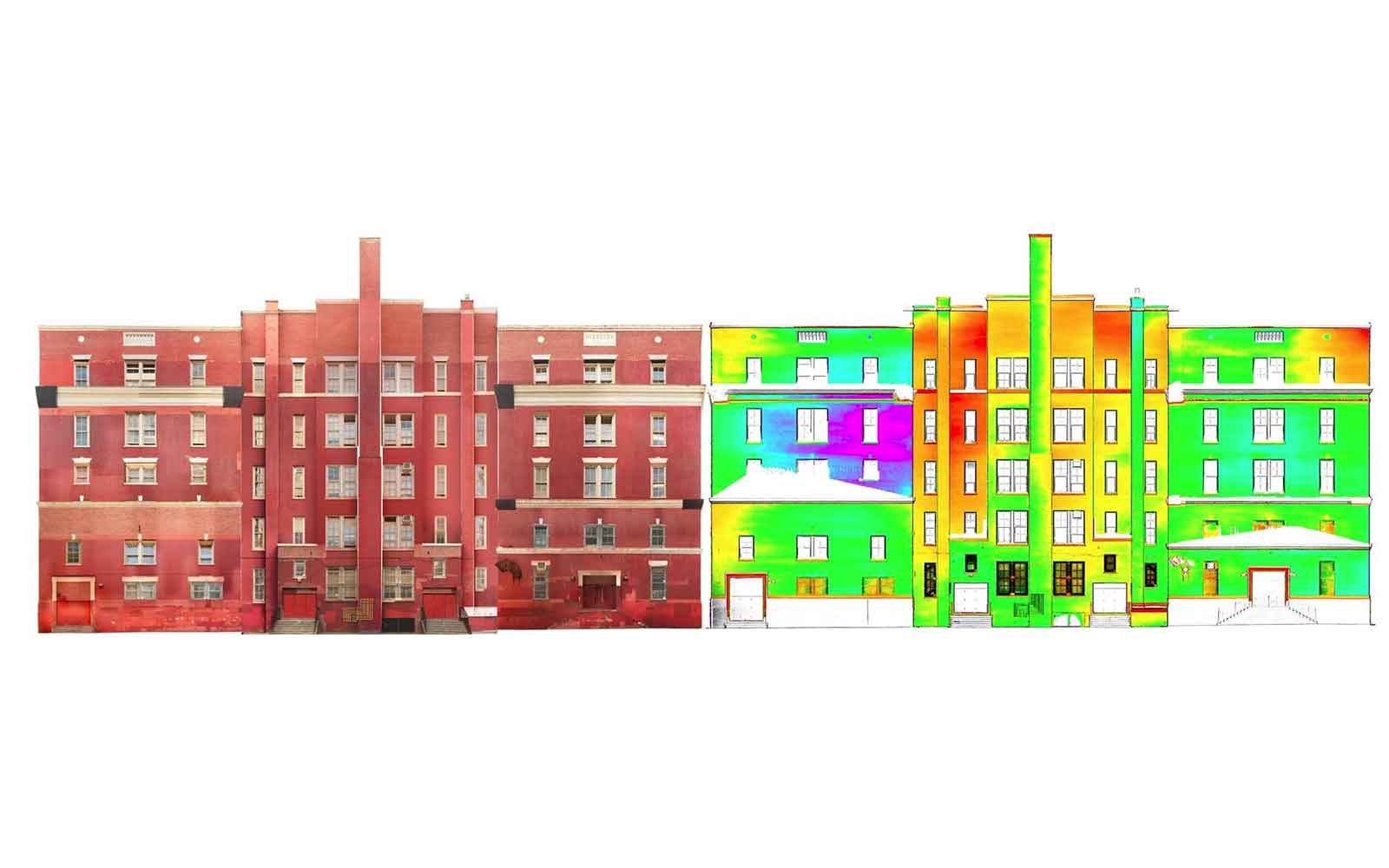
Rectified Photography & Verticality Assessment
Historic facade (left) collected using rectified photographs from ground level.Verticality contour plot (right) showing the verticality derived from point cloud data. This quantifies variations in verticality across the facade and pinpoints local deformations.
Featured Work
GBG investigates a wide range of structures from historically significant buildings to small private residences.

Contact Us
